Rivercast - River Levels, Forecasts & Flood Alerts
Rivercast® is the trusted river-monitoring app focused exclusively on the USA. Free to use on iOS and Android since 2012, it tracks real-time, historical, and forecast river levels at more than 12,000 gauges, and includes official National Weather Service flood alerts.
Concerned about flooding or water levels? Heading out to fish, boat, or paddle? Get the river conditions you depend on, right on your phone.
Rivercast Includes
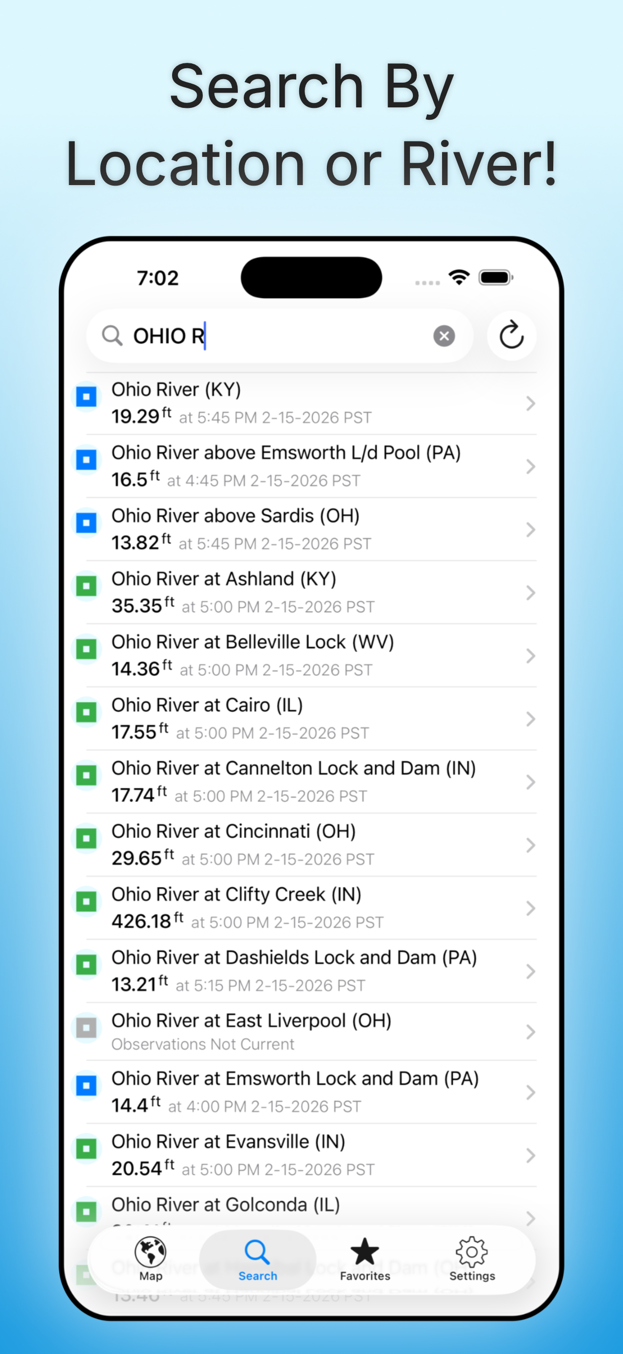
- Over 12,000 active gauges across the USA
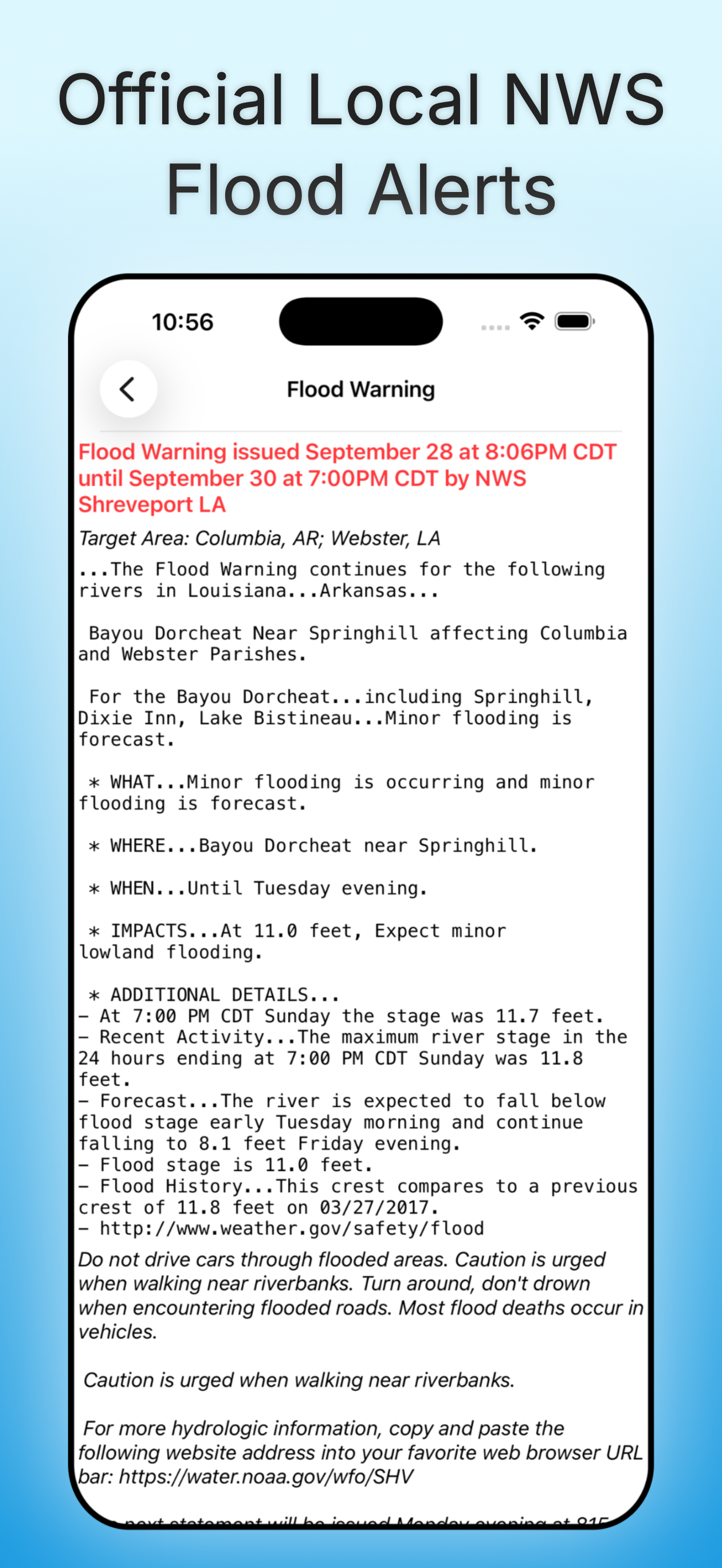
- Official flood warnings and alerts from the National Weather Service
- River stage height in feet
- River flow rate in CFS (when available)
- Color indicators showing when a river is normal, rising, or flooding
- Current observations and recent history
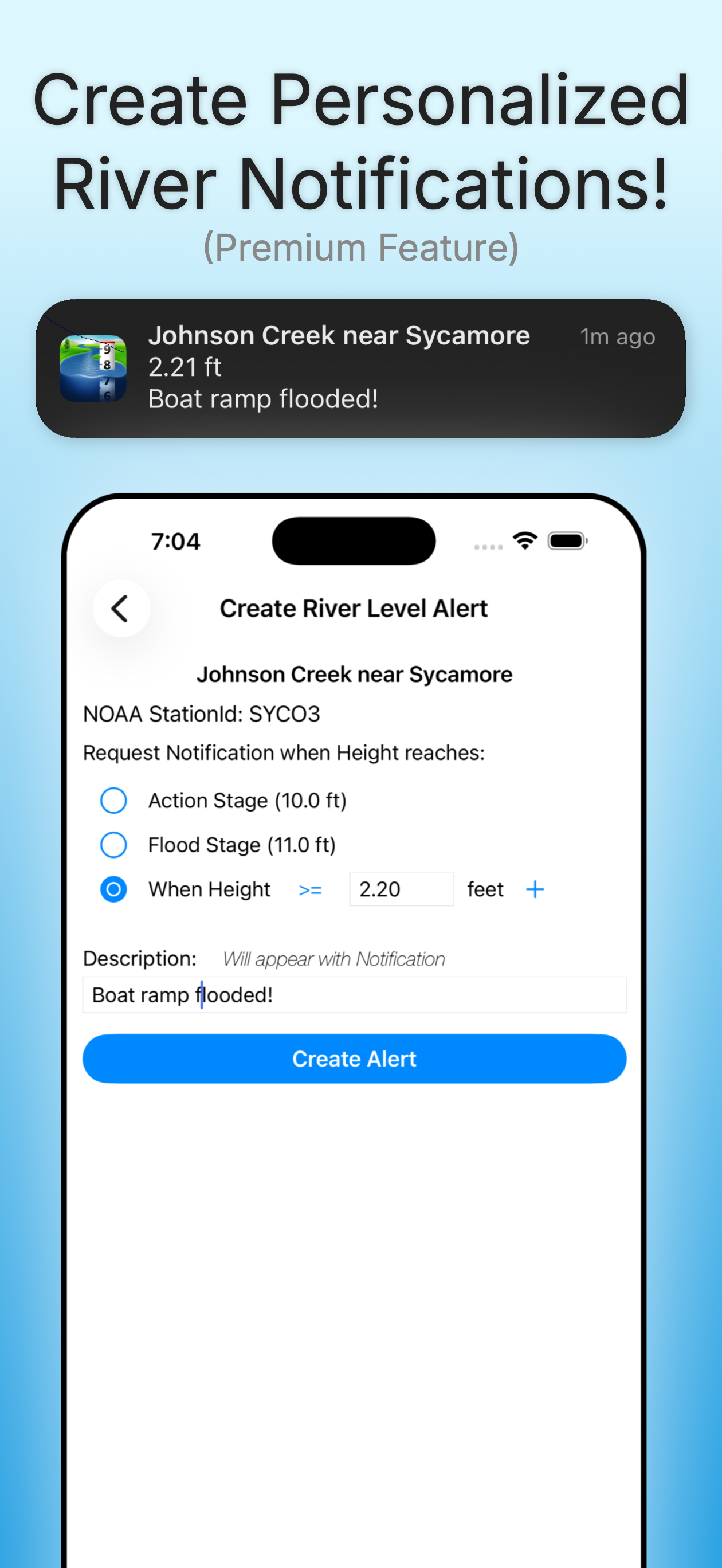
- Custom push notification alerts when a river reaches your chosen level (Premium feature)
- NOAA river forecasts (when available)
- Interactive map showing all nearby river gauges
- Search by waterway name, state, or NOAA 5-digit station ID
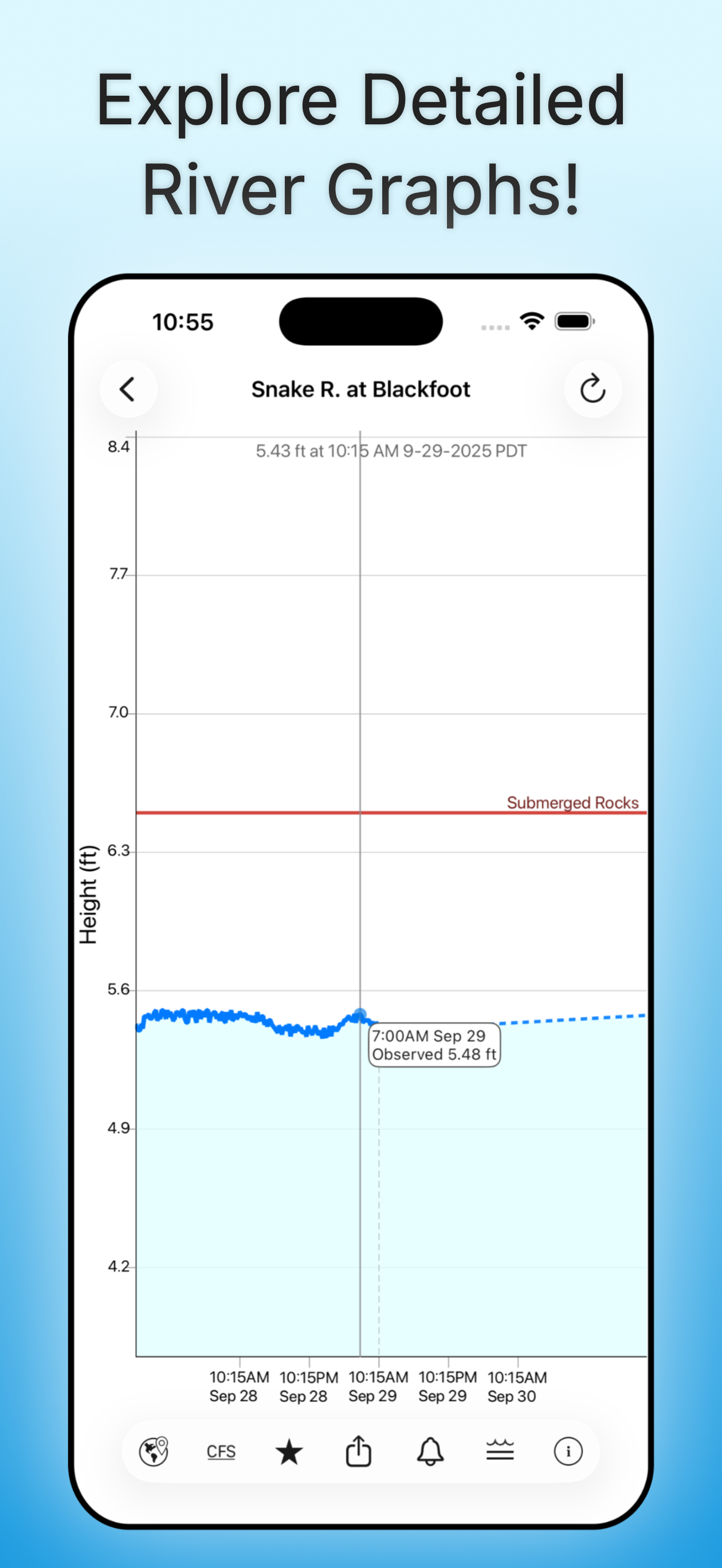
- Zoomable, pannable, interactive graphs
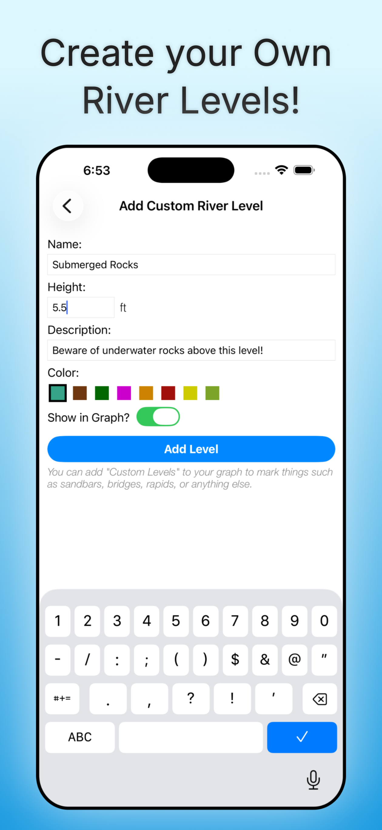
- Add your own reference lines for landmarks or safety levels
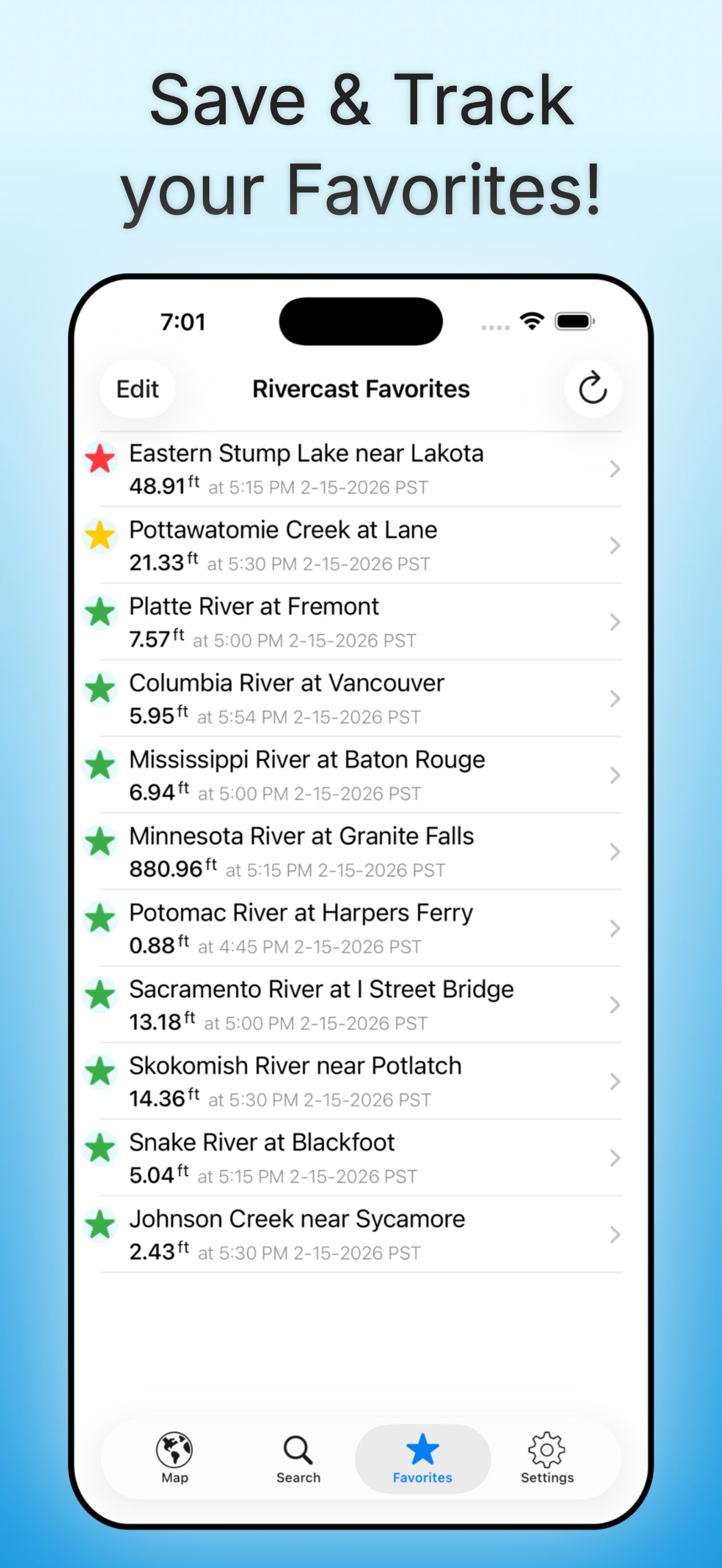
- Favorites list for quick access to your key locations
- Share graphs via Message, Email, Facebook, and more
- Dark Mode support
- Apple Watch companion app
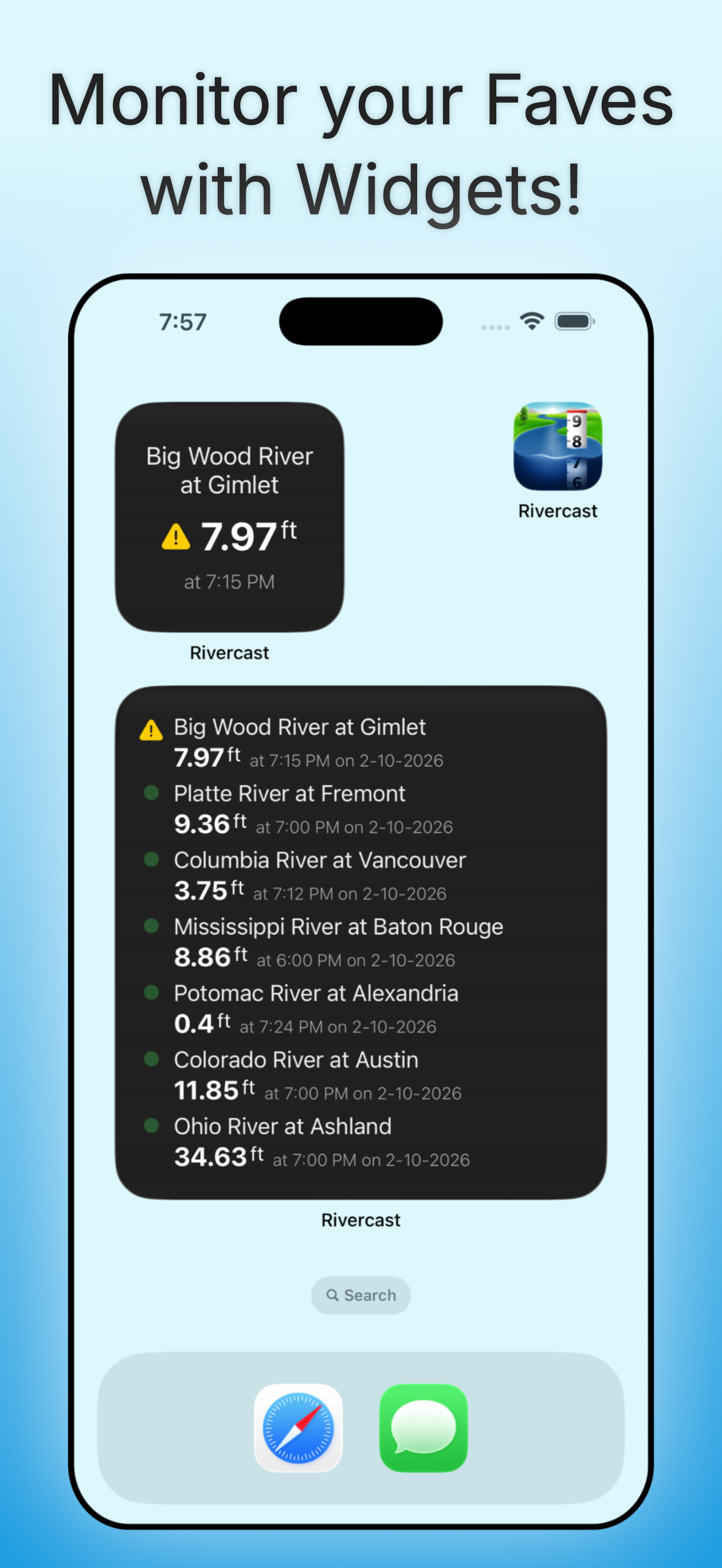
- Widgets to monitor your favorites
River data from official sources, presented clearly and responsibly. Designed for everyday use on iPhones, iPads, and Android devices.
Rivercast is free to use - with no tedious onboarding process or account creation needed. Optional premium upgrades are available.
Learn How Rivercast Works
Our guide walks you through using our map, reading & customizing hydrographs, setting river level alerts, and more!
Read the Rivercast Guide →Clear River Data at Your Fingertips
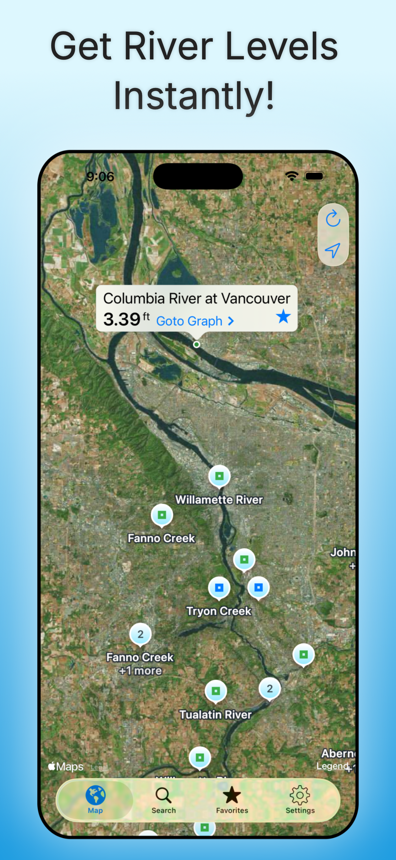
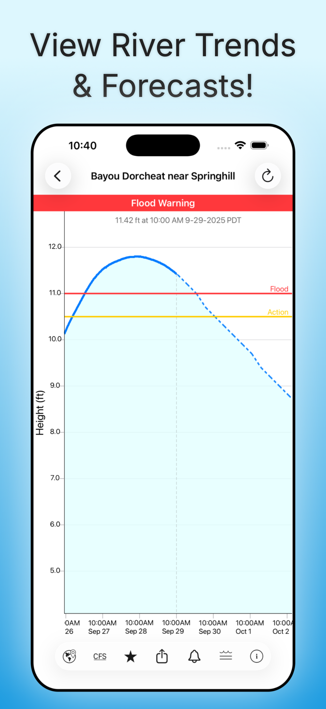
Rivercast's map not only shows where gauges are located, but color-codes them to indicate whether each station is at normal levels, approaching flood stage, or above flood stage.
Tap any location to view the latest observations or open an interactive graph for detailed trends. Pinch or drag to zoom and pan, or tap and hold for precise readings using the crosshair tool.
Customize your hydrographs with personal level markers for bridges, sandbars, rocks, or safe navigation levels. Add favorite gauges for quick monitoring anytime.
Rivercast uses official NOAA observation and forecast data and requires an internet connection for data access. Data is displayed in feet or cubic feet per second (CFS) when available, always shown in your local time.
A reliable tool since 2012 for boaters, fishermen, property owners, paddlers, whitewater rafters, scientists, and marine professionals who need clear, reliable river information.
We take our data seriously!
Some Frequently Asked Questions
Where does Rivercast get its data?
This app uses official data from the US National Weather Service (NWS), National Oceanic and Atmospheric Administration (NOAA), and National Water Prediction Service (NWPS) for its raw data for our custom graphing and mapping solutions. There are a few locations that are available via other government agencies (including USGS) that are not available via this app.
Is Rivercast free?
Yes. Rivercast is free to use with no account required. Optional premium upgrades add custom push notification alerts, the Apple Watch app, and more.
Why does Rivercast sometimes show slightly different flow data (CFS) than USGS?
CFS is a calculated estimate derived from stage height. NOAA and USGS estimates may sometimes slightly vary due to using different data models. Variances are usually within a few percent, but can sometimes be larger. Stage height should always be identical between USGS and NOAA. Designated flood stages are usually based on stage height in feet in the USA.
Why does Rivercast show only observations, but not forecasts, for my river?
NOAA issues forecasts for many, but not all, rivers it monitors. Sometimes forecasts are only issued seasonally, or during times of flooding or high water.
My river gauge was there yesterday, but it's gone today! What gives?
River gauges have a hard life. They occasionally have technical problems transmitting their data, or can even get washed out during extreme flooding. NOAA is usually pretty good about fixing them in a few days.
Can you add location xyz to your app?
We wish we could! If NOAA is not reporting it, we unfortunately are not able to add it. We include all stations that NOAA provides for public use.
I can find my location online, why can't I find it in the app?
There are some gauge locations run by USGS or other government agencies that you may be able to find online or other apps that are not available via Rivercast. NOAA and other government agencies have not yet made all the raw data (required for our custom graphing and mapping solutions) available for all locations. We will add additional gauges if the data becomes available.
Is it spelled river gauge or river gage?
Both spellings are in use and considered "correct". The US Geological Survey has standardized on "gage", but most other organizations (including NOAA) have standardized on "gauge". And in case anyone was wondering, "guage" is not a word.
Other questions? Our guide explains how to use our maps, graphs, widgets, river level alerts, and more!
Download for Free Today!
Questions or feedback? Email info@RivercastApp.com.
Copyright 2012 -
Juggernaut Technology, Inc.
Rivercast® is a registered trademark of Juggernaut Technology, Inc.
Would you like to know current and recent ocean conditions? Try NOAA Buoy Reports, our app that not only tells you current ocean buoy conditions, but past history up to 45 days!

Are you wiring new systems or rewiring old on your boat, RV, or car? Try WireSizer, our ABYC conforming wire gauge and voltage drop calculator!
Do you ever find yourself walking down a dock, scratching your head wondering, "Who made that boat?" Try HINSearchPlus, our Hull Identification Number lookup and more App!